
Koshi
Province of Nepal
Out Score
coming soon.
Out Score coming soon.
We're freshly researching the laws for every identity lens against our updated methodology. Koshi's scores will appear here once they're published.
Learn about Koshi
Beyond the scoreLearn about Koshi.Official names, languages, local time and practical context for understanding Koshi beyond its legal score.
Destination overview
About Koshi.
Where the world's highest peaks meet the jungle floor
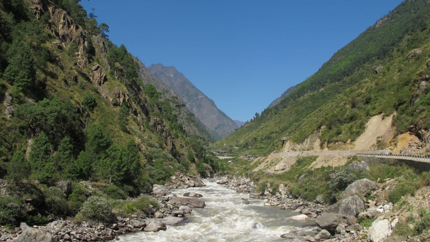
Koshi Province spans Nepal's full vertical range in a single glance, from the steamy alluvial plains of Jhapa where tea bushes ripple in the heat, all the way north to the permanent glaciers wrapping Kangchenjunga and the summit of Mount Everest. The Koshi River, the largest in the country, stitches it all together as it rushes south through gorges carved over millennia, pooling eventually into the Koshi Tappu Wildlife Reserve, a mosaic of grassland and floodplain that shelters wild buffalo, Gangetic dolphins, and more than five hundred species of birds. This is Nepal's easternmost province, and it carries the energy of a region that has always sat at a crossroads.
Read more about Koshi
A cultural heartland of the Kiranti people
The hill districts of Koshi are Rai and Limbu country, home to the ancient Kiranti civilisation whose oral scripture, the Mundhum, predates written records in the region. In village after village above the Arun and Tamur valleys, shamans called Nakchhong and Samba perform rituals timed to the agricultural year, and the Sakela festival draws communities together in spring and autumn for ceremonial dances that mime the movements of birds and animals. The region's linguistic diversity is extraordinary: more than ninety languages are spoken across its fourteen districts, a number that makes Koshi one of the most linguistically complex corners of South Asia.
Trekking beyond the well-worn trails
Most trekkers pass through Koshi on their way to Everest Base Camp via Lukla, but the province quietly harbours routes far less travelled and arguably more rewarding. The Arun Valley approach to Everest threads through Sherpa and Rai villages along a river corridor that naturalists have compared to the Amazon for its biodiversity, rising through subtropical forest into rhododendron groves before joining the main Khumbu trail near Solu. The Kangchenjunga Conservation Area in the far northeast offers multi-week circuits through yak pastures and high passes that rarely see more than a handful of trekking parties at a time. And the Milke Danda ridge, straddling several districts, rewards those who make the climb with a panorama sweeping from Everest to Kanchenjunga across a foreground of twenty-eight rhododendron species in full spring bloom.
Tea gardens, temple towns, and the energy of Biratnagar
Down in the lowlands, the mood shifts entirely. Ilam's terraced tea gardens produce some of Nepal's finest orthodox tea, best savoured with a view of the morning cloud lifting from the hills. Biratnagar, the provincial capital and Nepal's industrial heartland, hums with commerce and a pride that comes from being the city where modern Nepalese democracy found its earliest voice. Hindu pilgrimage sites at Pathivara, Halesi Mahadev, and Barahachhetra draw devotees from across the subcontinent, while the vibrant Maithili plains culture of the south brings a richness in music, painting, and festival that is entirely distinct from the hill traditions just a few hours' drive away.
Official and Indigenous Names
- Koshi Province (English)
- कोशी प्रदेश (Koshi Pradesh) (Nepali)
Region
- South Asia
Continent
- Asia
Resident population
4,961,412
2021 data
Capitals and seats of government
- BiratnagarBIR
Currency
- Nepalese Rupee (NPR · रु)
Driving side
- left side of the road
Electricity
Languages
Nepali
Official by law · Official in practice · ISO 639-3: nep
Bhojpuri
Official in practice · ISO 639-3: bho
Limbu
Official in practice · Indigenous · ISO 639-3: lif
Maithili
Official in practice · ISO 639-3: mai
Nepalese Sign Language
Official in practice · ISO 639-3: nsp
Show 10 more languages
Tamang
Official in practice · Indigenous · ISO 639-3: taj
Tharu
Official in practice · Indigenous · ISO 639-3: thl
Urdu
Official in practice · ISO 639-3: urd
Bantawa
Indigenous · ISO 639-3: bap
Chamling
Indigenous · ISO 639-3: rab
Magar
Indigenous · ISO 639-3: mgp
Newar
Indigenous · ISO 639-3: new
Rajbanshi
Indigenous · ISO 639-3: rjs
Santali
Indigenous · ISO 639-3: sat
Sherpa
Indigenous · ISO 639-3: xsr
Current time and time zone
Nepal TimeNPT
Asia/Kathmandu
Largest cities by resident population
- BiratnagarBIR · 244,750
2021 data
- Itahari · 198,098
2021 data
- Dharan · 159,652
2021 data
- Birtamod · 79,567
2021 data
- Damak · 72,910
2021 data
Busiest airports by total passengers
- Biratnagar AirportBIR · 486,000 annual passenger movements
2019 data
- Tumlingtar AirportTMI · 45,000 annual passenger movements
2019 data
- Chandragadhi AirportBDP · 38,000 annual passenger movements
2019 data