
Saba
Territory of the Kingdom of the Netherlands
Out Score
coming soon.
Out Score coming soon.
We're freshly researching the laws for every identity lens against our updated methodology. Saba's scores will appear here once they're published.
Learn about Saba
Beyond the scoreLearn about Saba.Official names, languages, local time and practical context for understanding Saba beyond its legal score.
Destination overview
About Saba.
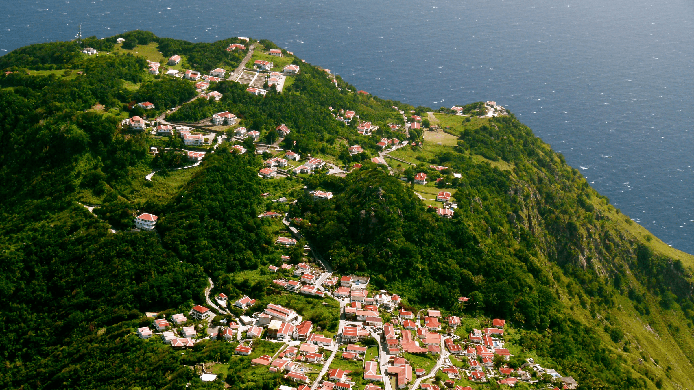
Saba is a small special municipality of the Netherlands in the northern Leeward Islands, rising steeply from the Caribbean Sea. The island is dominated by Mount Scenery, cloud forest and narrow volcanic ridges, with The Bottom as its capital and Windwardside as the main visitor village. Beaches are limited, so Saba’s appeal is centred on terrain, community and the surrounding sea.
Read more about Saba
Hiking trails climb through rainforest and cloud forest, pass historic paths and reach viewpoints above the island. The Saba Marine Park protects reefs, pinnacles and deeper dive sites, while villages contain cottages, small restaurants, craft traditions and gardens adapted to steep ground. The island’s scale makes walking and guided outdoor activities central to most visits.
Saba’s history includes Indigenous Caribbean presence, European settlement, African heritage, seafaring, migration and a long period of practical self-reliance. English is widely used in everyday life and Dutch is the official language of the public body. Local architecture, Saba lace, food, church communities and oral histories help explain how a small island society developed within the wider Dutch Caribbean.
Saba is reached mainly by short regional flights from Sint Maarten and by sea connections that depend on weather and operating schedules. There are few roads, no large resort zone and a limited range of accommodation, so visitors benefit from arranging transport, stays and activities ahead of time. The island rewards a slower itinerary built around hiking, diving, village life and changing mountain weather.
Official and Indigenous Names
- Saba (Dutch)
- Saba (English)
Region
- Caribbean
Continent
- North America
Resident population
2,270
2026 data
Capitals and seats of government
- The Bottom
Resident Population 795
2025 data
Currency
- United States Dollar (USD · US$)
Driving side
- right side of the road
Electricity
Languages
Dutch
Official by law · ISO 639-3: nld
English
Official by law · Official in practice · ISO 639-3: eng
Useful phrases in English
- Hello
- Hello
- Goodbye
- Goodbye
- Please
- Please
- Thank you
- Thank you
- Excuse me
- Excuse me
Current time and time zone
Atlantic Standard TimeAST
America/Kralendijk
Largest cities by resident population
- The Bottom · 795Urban Area
2025 data
- Windwardside · 693Urban Area
2025 data
- Zion's Hill · 449Urban Area
2025 data
- St John's · 219Urban Area
2025 data
Busiest airport by total passengers
- Juancho E. Yrausquin AirportSAB · 32,400 annual passenger movements
2025 data
Information reviewed 2 September 2026